Traffic unites us all in frustration. There is a unique anger that comes from being stuck in what feels like a never-ending gridlock, and an even more ferocious one when you wind up in that situation simply because you weren’t alerted to an accident. Luckily, we now have a flurry of apps that help alleviate those headaches with every new iteration. Whether tapping into existing infrastructure, mobilizing users, or building off proprietary tech, the current lineup of traffic apps do well to cut the time spent curtailing road rage. Here are 10 of the best currently available.
Mapquest
What better way to kick things off than with a name many haven’t thought of since the age of physically printing directions on paper? Surprisingly, Mapquest never really went away, even as companies with more powerful data-gathering programs easily lapped the former go-to. The switch to app actually delivers a solidly average experience. It’s fine with standard navigation and has some nice real-time traffic tools, including access to live traffic cameras, to keep you on the best path forward. Just keep an eye on your device’s charge as the app ranks near the top in battery chomping, especially when running in the background.
Traffic Spotter
Traffic Spotter is the perfect app for the overactive co-pilot obsessed with constantly updating traffic and weather conditions. The app delivers up-to-date traffic and weather information along your route, including specific locations and your final destination. It does that by leaning heavily on user-provided updates which allows for more detailed information than the generic updates other apps include. We still can’t figure out why it asks for access to your photos though.
Sigalert
Navigating the sprawling metropolises across the nation provides a particular frustration, especially as more cities sink further into bumper-to-bumper hell. Sigalert is a remedy specific to those areas, providing live traffic updates and access to cameras in many metro areas. Users can personalize routes within the app which displays information specific to your needs. Sigalert isn’t the most robust tool, but it gets the job done should you desire something tailored to the urban environment of your choice.
Apple Maps
The early days of synergy between Apple devices and Google’s mapmaking tech (more on that later) have been gone for some time now. But that obviously didn’t mean that Apple would let the iPhone exist without its own proprietary map app. Apple Maps gets the job done well enough, but it does lag a tad behind Google’s offering when it comes to populating locations in lesser known environments.
Inrix
Inrix feels like the perfect partner to those of us with regular daily commutes. The app tracks the routes you typically drive and builds a custom schedule for you, monitoring traffic conditions as their reported by other users. It also packs in tools for finding parking around your current location or your final destination. The app even tells the optimal time to leave based on current conditions. But Inrix’s best feature is that it is completely ad-free. Who needs all that clutter?
Sygic
Sygic is the app for those that prefer the premium route. The service delivers the standard toolset expected from a mapping and traffic app with just a step above the visual quality of other apps. Real-view navigation, 3D maps and a HUD projected onto your car’s windshield provide more than enough bells and whistles for those wanting a little extra. It’ll cost a little extra, too. Many of Sygic’s more intriguing add-ons cost up to $20.
Here WeGo
Where Inrix caters to commuters, Here WeGo does the same for anyone navigating cities’ public transit systems. It still works well for drivers thanks to stellar traffic monitoring and the ability to download maps for online use. But the app really shines in its incorporation of public transit information, including displaying fares and system maps. It even suggests the best mode of transportation for the given conditions at your location.
USA Traffic Cameras
If you’re the type of person who wants a dash of voyeurism with your real-time traffic updates then USA Traffic Cameras is calling your name. This no-frills program connects you to traffic cameras that monitor traffic levels in more than 200 cities. It takes some extra work to fully utilize the app’s tools, but the return is worth it. Users can even save specific cameras if there is an area you’d like to regularly monitor. USA Traffic Cameras is a solid companion to your favorite mapping app.
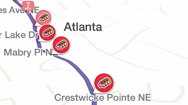
Waze
One of the two traffic behemoths, Waze needs little introduction. The app perfected real-time route adjustment, due in part to its wide user base contributing real-time traffic information. Waze made that and many other features standard in recent years, establishing itself as a trendsetter in the industry. That flexibility does come to the detriment of the app’s interface. Waze’s seemingly endless wave of widgets, ads and Spotify notifications can obfuscate the map. It’s a small yet irksome characteristic, but it doesn’t outweigh Waze’s positives.
Google Maps
Google’s trademark program remains the tried and true top dog of traffic apps. Google Maps doesn’t do anything beyond the scope of its competitors. It even lags behind others in new and unique developments. But what it sacrifices in flash it reinvests into performance. No other app holds a candle to Google’s cartography tech, providing the most accurate, up-to-date location information. There’s a reason why the flagship has maintained its staying power so many years later. Being preloaded on Android devices doesn’t hurt either.
Brian Bell is a queer freelance writer covering tech, pro wrestling, esports, games, comics and TV. Co-host of the Mr. Videogames Super Show podcast. Find and follow him on Twitter @WonderboyOTM.